Visitors of radarvirtuel.com get a lot of attention during their first visit. The flight radar guides the user through a Tutorial. Thus the inexperienced user learns about all possibilities of flight tracking.
The map, the aircraft symbols, zooming in and out, different colour variations, different filter functions, how an airspace can be accessed and how to contact the website operators are explained.
RadarVirtuel – Differences with other Flight Radars
Users of RadarVirtuel navigate on an interface that is clearly different to those of other flight radars. A small difference is, for example, the representation of the aircraft in blue. Radarbox24 and Flightradar24 show them in yellow. RadarVirtuel also shows the grand total of the aircrafts currently displayed on the map. This is done in the upper right corner of the window. In addition to the number of aircrafts, the number of radar sources installed worldwide is also indicated.
An interesting feature of RadarVirtuel Flight Radar is that the radar stations are also displayed on the map. Furthermore, the map also differs in the colour scheme and in the identification of other content elements.

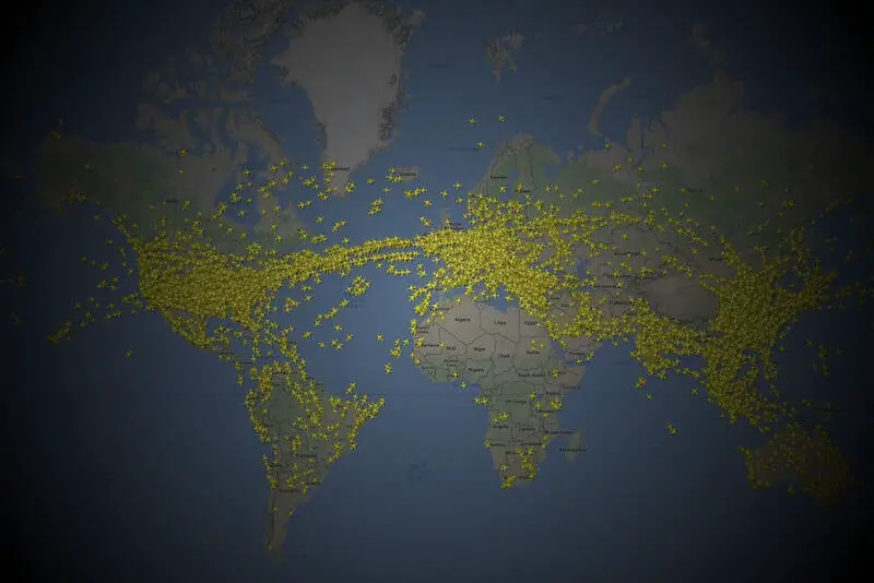
How does radarvirtuel.com work
After loading for a little while, aircrafts appear on the map. As soon as an aircraft is visible, it can be accessed by tab or click. Unlike e.g. Radarbox24, the data is not displayed with a delay. All information is available in real time. When the user clicks on an aircraft, a wealth of information is available:
- Callsign
- Model
- Reg Code
- Abbreviation of the Airport of Departure
- Abbreviation of the Airport of Arrival
- Remaining Flight Distance
- Ground speed
- Vertical Speed
- Flight Altitude
Account Models on RadarVirtuel
RadarVirtuel offers registered users a number of extra features. The following list shows these features, based on two different types of available registrations (“Classic” and “Contributer”)
- Technical Details
- Numerous Filters
- Layer Waypoints
- Repeat Flights
- Layer FIR & Sectors
- Interface of the Contribution
- Members-only Page
- 3D Rendering
- 3D Mapping
- Diagram of Reception
RadarVirtuel comes in Beta
According to the operator RadarVirtuel is still in the Beta Version. This means that daily work is being done on the website and further improvements are to be expected. The operator also points out that malfunctions are to be expected when tracking flights. Anomalies are also to be expected during flight tracking.
Nevertheless, the service providers have decided to finance this flight radar through advertisement. Advertisements are embedded in the lower part of the map. The provider obviously intends to offer the website in other languages in the future. Users are encouraged to provide feedback if they have suggestions for improvement or concerns about the service.
About RadarVirtuel
Ron Duval launched RadarVirtuel.com in 2009. The creator of the website was pursuing his passion for aircrafts. In 2010, the eruption of the Icelandic volcano Eyjafjallajökull resulted in numerous user logins to the website. This rush could not be managed by the servers at that time. The website was thus temporarily unavailable. For about half a day, live tracking on RadarVirtuel.com was not possible.
The mass influx of visitors could only be managed with the help of Julio Misno, a Digitube employee. To this day RadarVirtuel.com remains grateful to this man. In June 2010 it was decided to establish a company called “Open Sky Map“. Unfortunately, operations had to be discontinued as early as 2012 – despite numerous prizes won by the company. The reason being there were no customers.
In 2014 a new company was founded. The new company is known as ADS-B Network. This company addresses the needs of professional flight service operators. ADS-B Network is available at adsbnetwork.com.

Conclusion on RadarVirtuel
In summary, RadarVirtuel is a kind of by-product of the ADS-B network.
In fact, RadarVirtuel has achieved fame in the past for its representation of the effects of the ash cloud from an Icelandic volcano. The website chip.de, among others, reported that the app enables the monitoring of the effects in real-time. However, even in the reports on the radar, there was already an indication that the website was repeatedly at a standstill due to high usage.
The loading time of the live map seems to be a little long. Some time will pass before users can start tracking flights. Given that flights are increasingly being tracked via mobile devices, the loading time is a determining factor for the service. Not meeting the needs of the users may not be a good sign for the future of RadarVirtuel.

Another point of criticism is that data is not yet being transmitted to the service provider in a standardized way via SSL. Apparently RadarVirtuel has so far not been able to deploy via https by default. The increasingly restrictive handling of non-SSL pages by search engines such as Google and Bing will further increase the pressure.
Further Information about RadarVirtuel and Sources:
The information on this website are based on https://www.radarvirtuel.com/ as well as news information about the provider.